


Borne au Lion - crêt du Merle - crêt de Chalam

cron
User
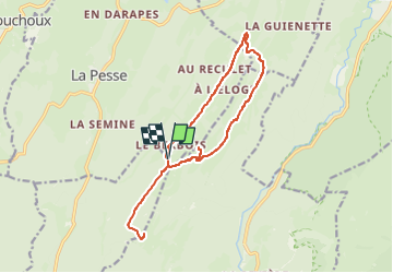

Length
14.8 km

Max alt
1524 m

Uphill gradient
586 m
Km-Effort
23 km

Min alt
1259 m

Downhill gradient
584 m
Boucle
Yes
Creation date :
2024-03-06 10:26:26.165
Updated on :
2024-03-06 10:34:59.947
5h08
Difficulty : Difficult

FREE GPS app for hiking
 SityTrail
IGN / Geographical institutes
SityTrail Plus
The world is yours!
About
Trail Walking of 14.8 km to be discovered at Bourgogne-Franche-Comté, Jura, La Pesse. This trail is proposed by cron.
Description
La montée au crêt de Chalam est optionnelle. Sans cette option, le dénivelé positif n'est que de 335 m et la distance totale est ramenée à 11 km.
Positioning
Country:
France
Region :
Bourgogne-Franche-Comté
Department/Province :
Jura
Municipality :
La Pesse
Location:
Unknown
Start:(Dec)
Start:(UTM)
721087 ; 5127692 (31T) N.
Comments